
Summary
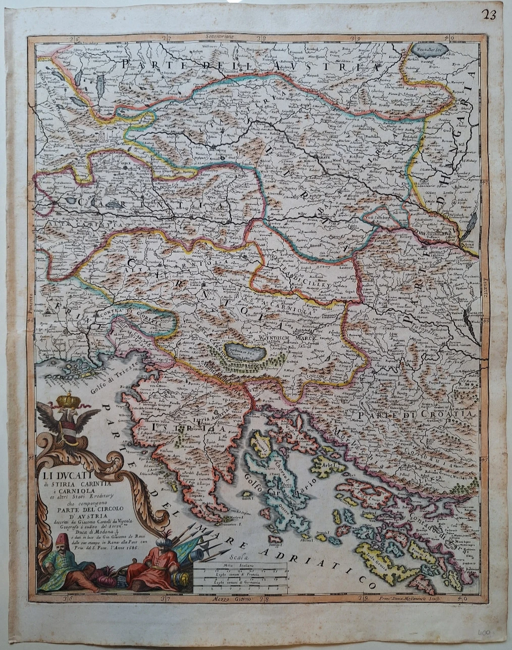
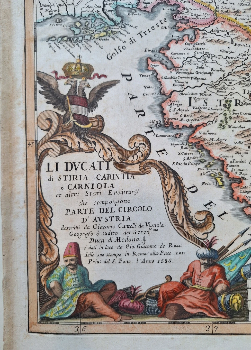
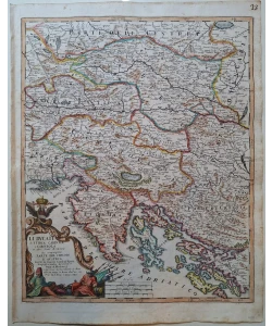
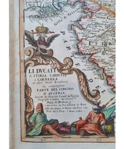
Giacomo Cantelli da Vignola: Li ducati di Stiria, Carintia e Carniola
Et altri Stati Ereditary che compongono parte del circolo d'Austria
Cantelli's map of Styria, Carniola and Carinthia also shows the whole of Istria, Primorje, the western part of Croatia and the northern part of Dalmatia. It was published in Cantelli's atlas "Mercurio Geografico" published by the Roman publisher and printer Giacomo Rossi in 1690. Although Cantelli's other maps are among the most accurate depictions of Croatian lands in the 17th century, this map deviates from that rule. Considerable deformations are visible in the representation of the coastline and contour of the island. The northern part of the island of Cres with the village of Porozina (Perosina) is shown as a separate island. The island of Pag (Pago) is barely recognizable like the northern Dalmatian islands of Pašman (Pasman) and Dugi otok (Isola Grossa). Forest cover is indicated by a tree symbol only in the area around Cerkniški jezera. The title of the map is in the lower left corner of the map in a lavish baroque cartouche decorated with figures of bound Turkish soldiers and numerous flags and weapons that remind of the fact that the map was created during another Venetian-Turkish war in which the Republic of Venice pushed the Turks out of part of the Dalmatian hinterland. CANTELLI DA VIGNOLA, GIACOMO (1643-1695) is one of the most important Italian cartographers of the 17th century. After studying in Bologna, he went to Paris, where he collaborated with the greatest French cartographers of the time – Sanson and Duval. Since 1675, he has been living permanently in Rome, working on his atlas "Mercurio Geografico", which came out in 1692 from the printing workshop of Giacomo de Rossi in Rome.
Biblos Newsletter
New titles, special copies and quiet recommendations from the antiquarian bookshop.