Summary
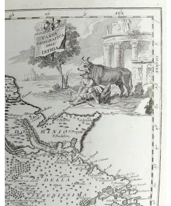
Giovanni Salmon: Carta geografica dell' Istria - Map of Istria
Copper engraving
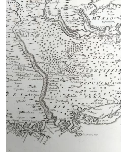
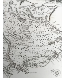
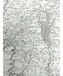
The map shows Istria divided into Venetian Istria and the County of Pazin, which was under the administration of the Habsburg Monarchy. The rivers Mirna and Dragonja with their tributaries are drawn with particular attention. Judging by the large number of coastal toponyms compared to land ones, the author obviously made extensive use of Venetian nautical charts. The map was published on Salmon's work "Lo stato presente di tutti i paesi e popoli del mondo".
Giovanni Salmon (1679-1767), English historian and geographer who worked in Venice. He published maps of Istria and Dalmatia in the book Lo stato presente di tutti i paesi e popoli del Mondo, published by Albrizzi in Venice in 1734 and 1753 and by Ricciardi in Naples in 1738, 1744 and 1746. Among the published works is part of the maps of Istria and Dalmatia. In the mid-30s of the 18th century, he accompanied Georg Anson on his travels around the world. When making his maps, he obviously used Venetian nautical charts of the area shown. He published Modern History 1725-1738, where Moll collaborated on the creation of the maps. In the middle of the century, he published The Universal Traveller, or a Compleat Description of the several Nations of the World in London.
Biblos Newsletter
New titles, special copies and quiet recommendations from the antiquarian bookshop.