

Summary
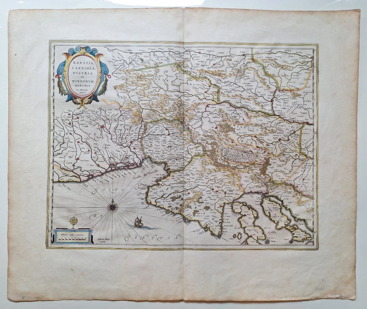
Gerhard Mercator: Karstia Carniola Histria et Windorvm Marchia / Map of Karst, Carniola, Istria and Slovenian Mark
Gerhard Mercator's map of Karst, Carniola, Istria and Slovenian Marka was published for the first time in Mercator's atlas in 1589. called "Forum Iulium". It was later taken over by other Dutch publishers. Here we see it in the edition of Johann Blaeu, who published it in his atlas "Atlas Maior". From the Croatian lands, the map shows the Istrian peninsula with the Kvarner Gulf. Istria is shown with many shortcomings. In the hinterland of Istria, the burning nature of Ćićarija and Gorski kotar is highlighted. The title is in the upper left corner of the map in a Renaissance cartouche. The graphic scale is expressed in Italian miles, which is highlighted in the lower left corner. Above the scale is drawn a globe, the symbol of the cartographic workshop of the Blaeu family.
Gerhard Kremer, better known as Gerhard Mercator (1512-1594), is, apart from Ortelius, the most famous Dutch cartographer. Unlike his Dutch contemporaries, he made his atlas maps himself. In general, he fought against the copying of other people's maps and the use of descriptive sources and stood up for the mathematical and geodetic basis of maps. In 1569, he published a map of the world in the new Mercator projection, which will also be his greatest merit in the development of cartography. Mercator's complete atlas was published in 1595 by his successors under the title "Atlas sive Cosmograficae". That atlas was preceded by several smaller collections of maps published during Mercator's lifetime. His maps of the New World, in which he outlined new discoveries, are particularly valuable. However, Mercator's interest was focused on Western Europe and the New World. For the Croatian lands, due to the circumstances of the war, he mainly uses numerous older sources, which is particularly evident in the drawn medieval borders and counties. His maps "Slavoniae, Croatiae, Bosniae cum Dalmatiae" and "Karstia, Carniola, Histria, Windorum Marchia" show a picture of the Croatian lands before the invasion of the Turks. His atlas saw about 40 editions.
Biblos Newsletter
New titles, special copies and quiet recommendations from the antiquarian bookshop.