


Summary
Valle Giovanni: La Dalmazia Veneta / Venetian Dalmatia
copper engraving
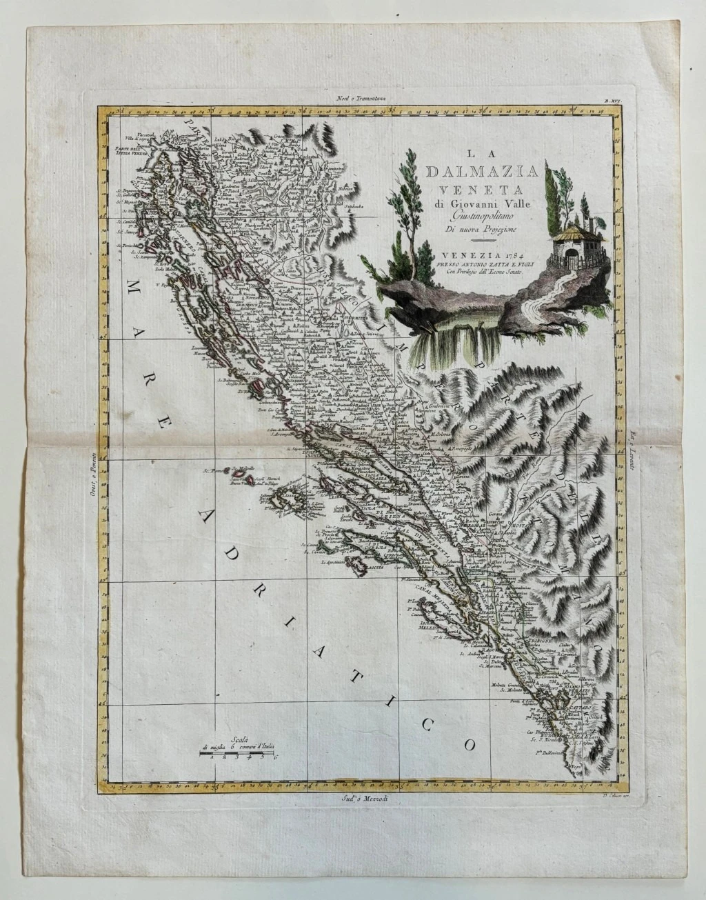
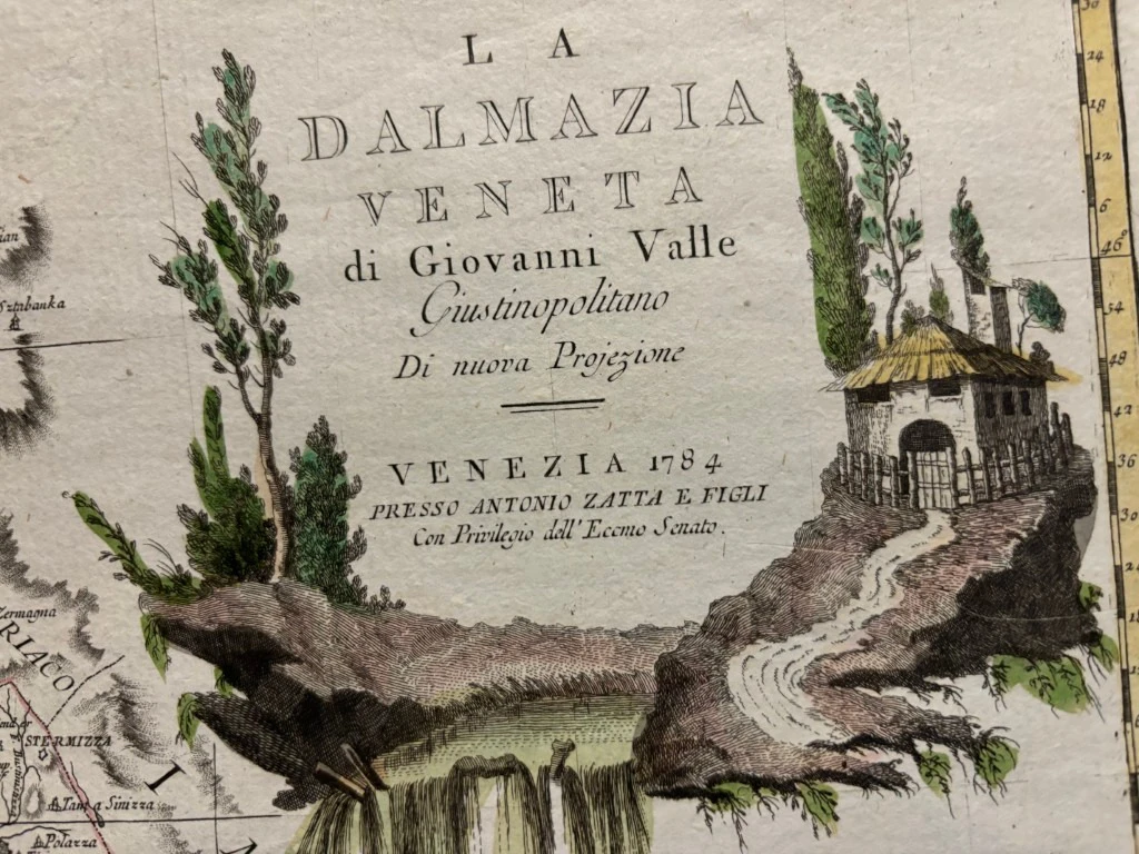
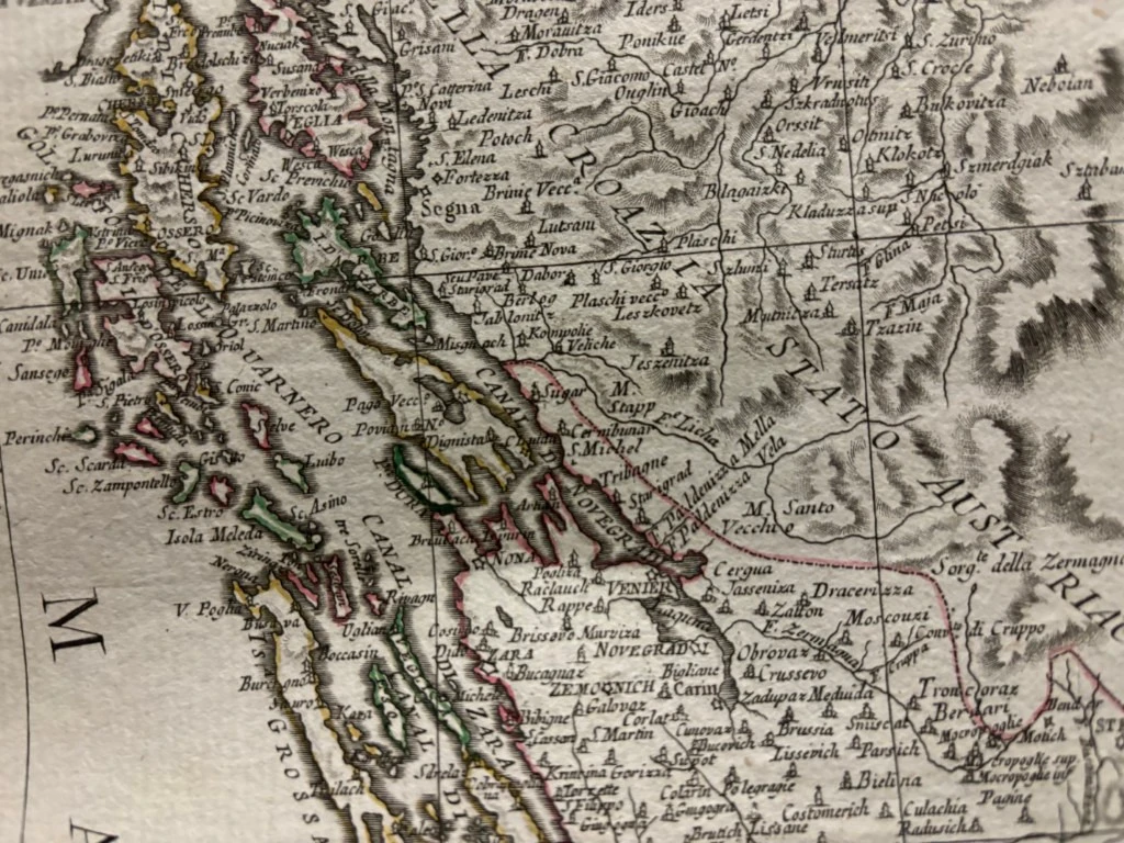
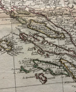
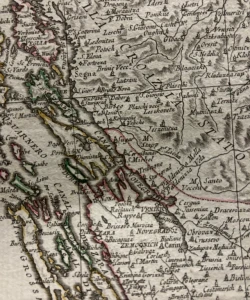
This is a map of Dalmatia published in Antonio Zatta's atlas. It shows Venetian Dalmatia in its borders after the peace in Požarevac concluded between the Republic of Venice and the Ottoman Empire in 1718. Today's northern borders of Dalmatia were largely created with it. The borders of the Republic of Dubrovnik and the Turkish corridors on Klek and Sutorina are also marked. The title of the map is in the upper right corner of the map. The scale of the landmass is expressed in ordinary Italian miles (Miglia communi d' Italia).
Giovanni (Ivan) Valle (1752 – 1819), publisher, geographer, surveyor and cartographer. He worked as a cartographer for the Venetian, French and Austrian authorities. He decorated his works with decorative motifs and vedutas. In 1782, he drew up a plan of Padua for Girolamo Zuliani, the Venetian ambassador in Rome, over which there is controversy over his authorship. In 1784, he published two maps of Istria. The depiction of northern Istria is titled Parte Settentrionale dell'Istria, and the depiction of southern Istria is Parte Meridionale dell'Istria. Both maps come from the atlas of A. Zatta, Venice, 1784. For the second edition of the map in 1792, he made numerous corrections, so it can be considered a new map. The geographic system of the map has been improved and the orientation of the peninsula in relation to the north has been improved. Identical to the previous map, the reliable representation of the indented coast remained, as well as a multitude of toponyms. His maps of Istria from 1784 and 1782 are the best cartographic models from the end of the 18th century, according to Marković (1993), the west coast of the Istrian peninsula on the map of Istria from 1784 has a north-south direction, hence the somewhat strange shape of the whole of Istria. The relief is shown by means of screws, but unsatisfactorily. Even the depiction of Učka was omitted. In the second edition, he fixed it to some extent. A copy of the Parte Settentrionale dell'Istria map is in the Museum of the City of Trogir. In the same atlas of A. Zatta, a map of Venetian Dalmatia, La dalmazia Veneta, was published, which included the area on the mainland from Karlovac, across the Dinara mountain to Mostar, and along the coast from the Gulf of Rijeka to northern Albania. In Stancovich's Biografia... from 1829, written apologetically, there is information that Valle made a map of Polesina with Ferrarwse, a map of the surroundings of Padua, "one of the most accurate and detailed of its kind" for the hall of the Academy in Padua in 1793, and a map of Dalmatia and Istria. He started making a map of the longer area, but he was hindered by political events and the collapse of the Venetian Reublica.
Biblos Newsletter
New titles, special copies and quiet recommendations from the antiquarian bookshop.