
Biller Bernhard: Zemljovid Zagrebačke županije
€ 200,00
Free delivery in Croatia for orders over EUR 70
Basic information
- Author: Biller Bernhard
- Publisher: Antal Amade de Várkony
- Availability: Available
- Condition: Vrlo dobro
- Code: 12319
Shipping options
GLS Croatia
5€
Delivery
0€
Personal collection at the antique store
0€
GLS parcel machine
3€
Payment methods
Pay on pickup
CorvusPay
By general payment / Virman / Internet banking
Cash on delivery
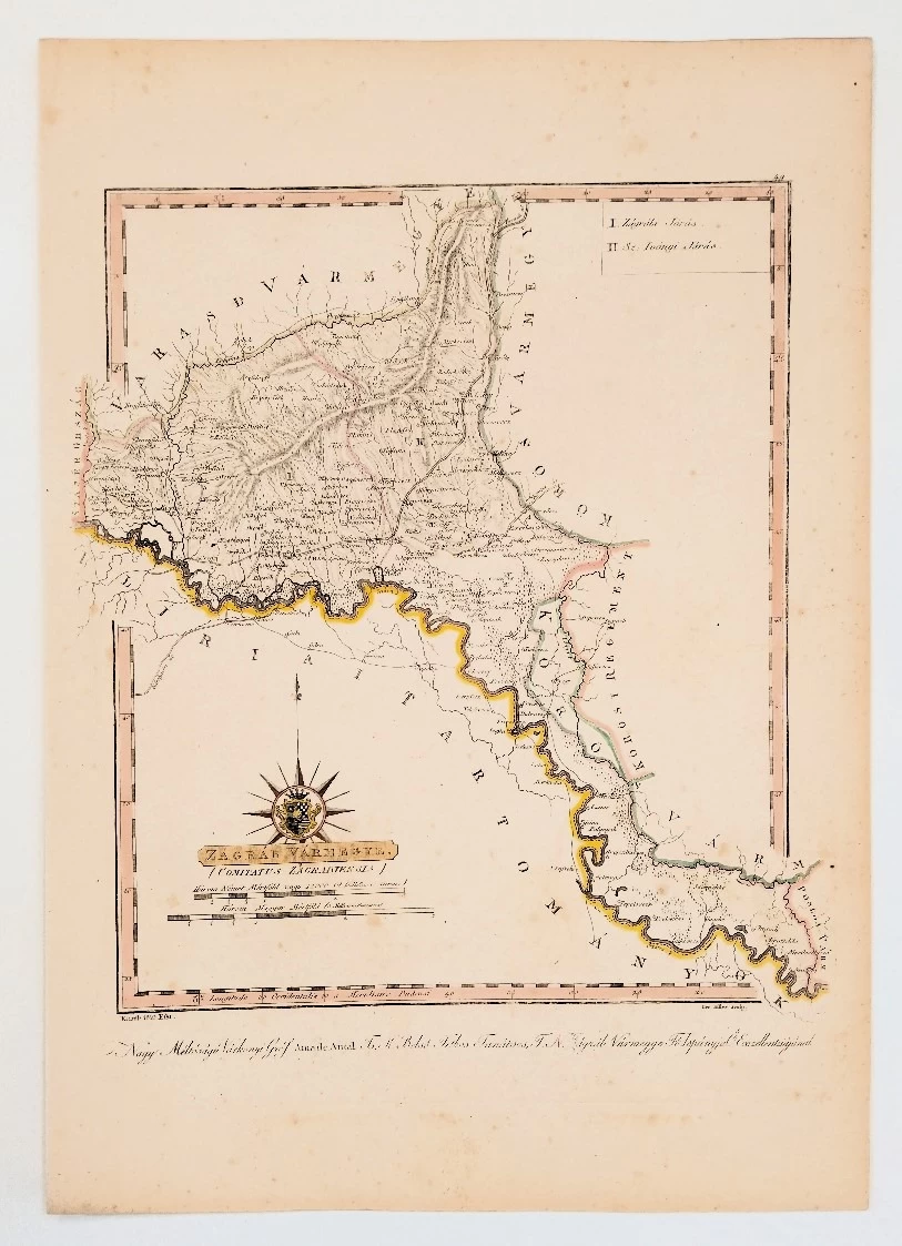
Zemljovid Zagrebačke županije
Biller Bernhard
Summary
Bernhard Biller: Zagreb Varmegye - Map of Zagreb County
Map of Zagreb County, Croatia. Presentation of administrative borders, cities, settlements, rivers, forests and mountains. Contains legend and coat of arms. The relief shown by the church., The first modern atlas of Hungary, made using modern research and methods. It was first issued incomplete with the title page in 1802, and the remaining sheets were issued over the next 9 years between 1796-1811. Including tables of Hungarian, Croatian and Slovenian lands, free regions and Military territories.
Additional information
- Author: Biller Bernhard
- Publisher: Antal Amade de Várkony
- Year of publication:1810
- Place of publication:Mađarska
- Pages:-
- Dimensions:30.5x43 cm
- Script:Latinica
- Condition:Vrlo dobro
You may also like


Recently viewed

Biblos Newsletter
For book lovers who enjoy finding the rare
New titles, special copies and quiet recommendations from the antiquarian bookshop.