


Summary
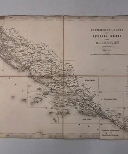
Special-Karte des Koenigreiches Dalmatien Astronomisch-trigonometrisch vermessen
Special map of the Kingdom of Dalmatia. Astronomically-trigonometrically measured, topographically recorded, reduced, drawn and engraved by the K. K. Military Geographical Institute in Vienna. Issued in the years 1861 to 1863. Issued in 1873.
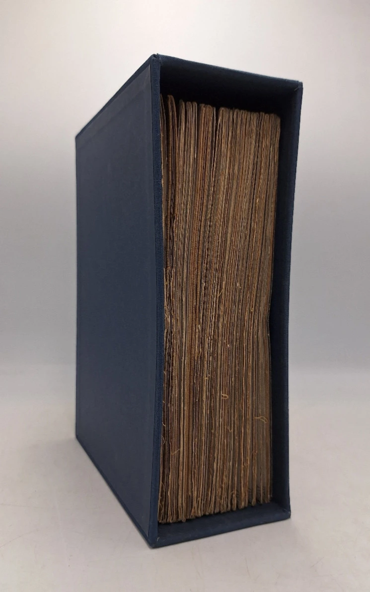
22 map sheets of 4 sections mounted on canvas and folding (sheet size approx. 27 x 40 cm). In a modern cardboard box.
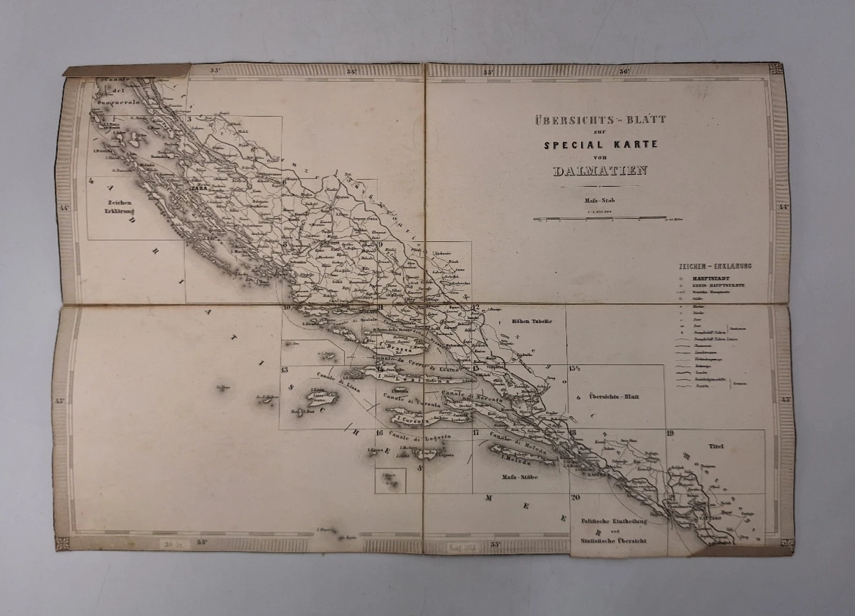
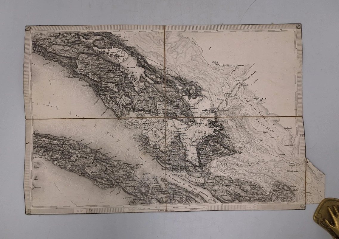
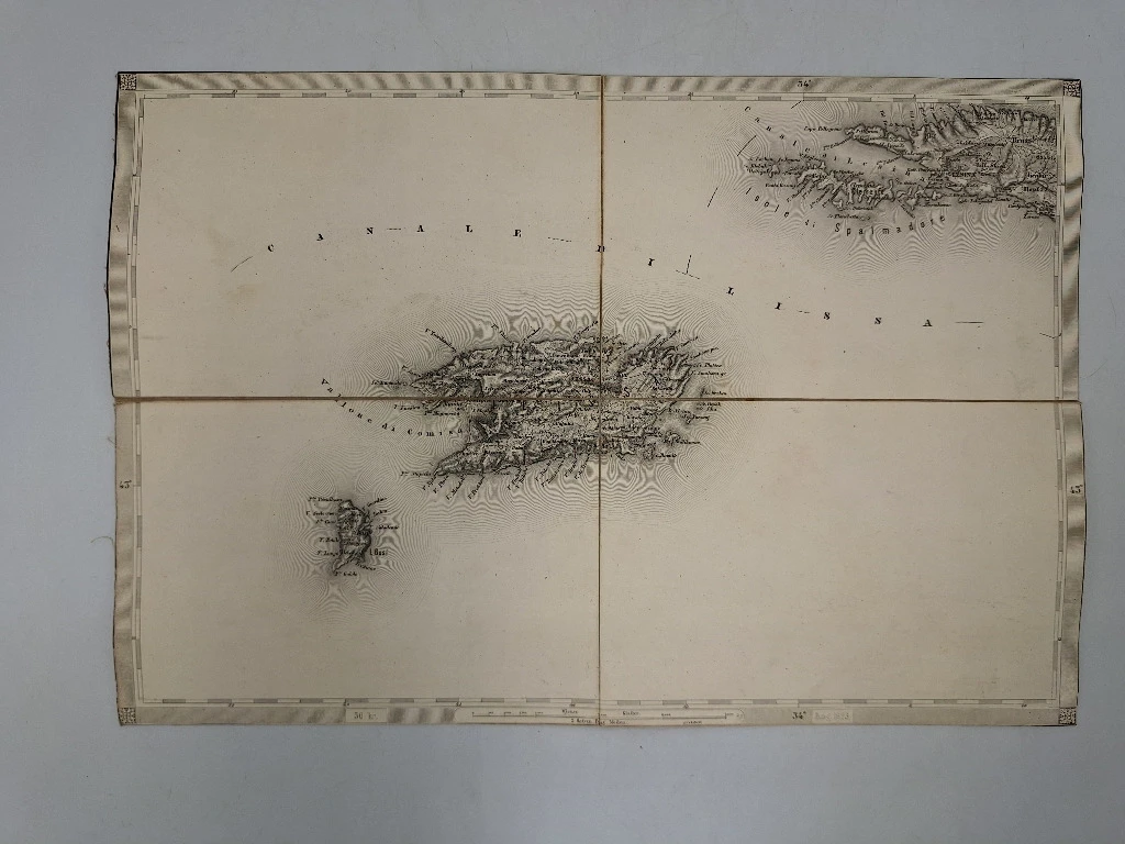
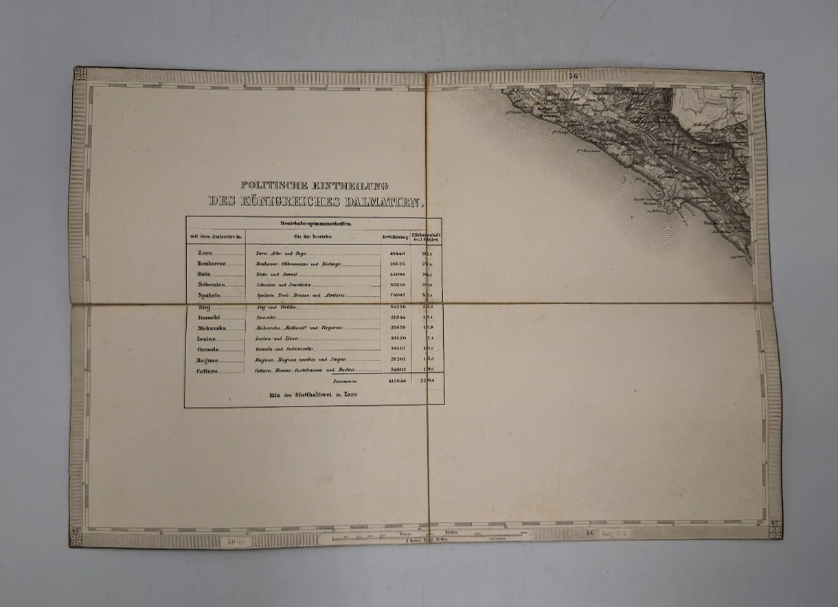
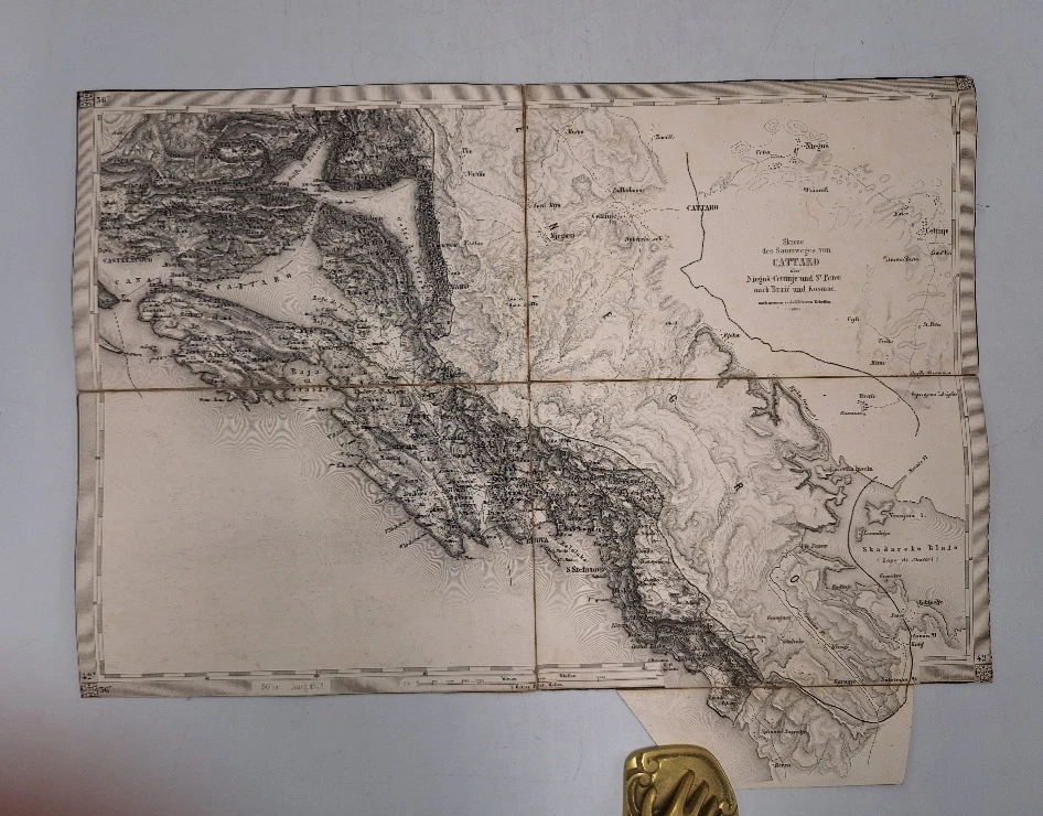
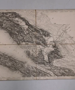
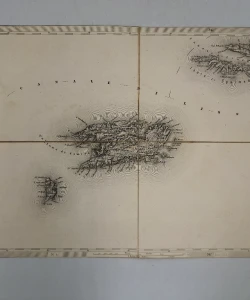
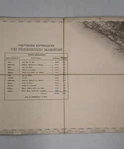
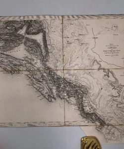
With overview sheet and 21 map sheets, a complete special map of Dalmatia. The most detailed and accurate map of the area of that time. The basis of the map is the Franciscan cadastral survey. The benchmarks set special maps not only with accuracy and wealth of geographic information, but also with good readability and transparency. From the 'Franciscan State Survey', the maps of individual countries of the Monarchy came out on a scale of 1:144,000, planned as a single map covering the entire area, but the individual maps of individual crown countries did not match. "Austria Picta". 1) "Arbe" 2) "Pago und die Inseln Ugljan und Lunga nebst Zeichen Erklärung) Zeyn "Inseln Incoronata und Zuri" Lagosta" 17) "Stagno und die Insel Meleda".- 18) "Ragusa"- 19) "Dragail und der The Die Spezialkarte w politischen Eintheilung und statistischen Uebersicht"-21) "Cattaro"-22)
Biblos Newsletter
New titles, special copies and quiet recommendations from the antiquarian bookshop.