
Ruscelli Girolamo: Tavola nuova di Schiavonia
€ 450,00
Free delivery in Croatia for orders over EUR 70
Basic information
- Author: Ruscelli Girolamo
- Publisher: -
- Availability: Available
- Condition: Vrlo dobro
- Code: 11700
Shipping options
GLS Croatia
5€
Delivery
0€
Personal collection at the antique store
0€
GLS parcel machine
3€
Payment methods
Pay on pickup
CorvusPay
By general payment / Virman / Internet banking
Cash on delivery
Tavola nuova di Schiavonia
Ruscelli Girolamo
Summary
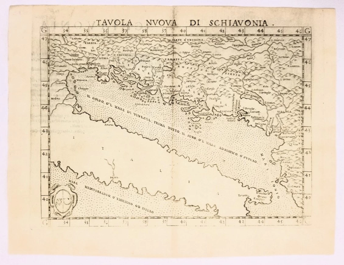
Girolamo Ruscelli: Tavola nuova di Schiavonia
The map is from his work La Geografia di Claudio Tolomeo Alessandrino. Based on the works of Claudius Ptolemy and an atlas by Giacomo Gastaldi, it focuses on the Balkans, the 'Powder Kegs of Europe' and the many countries where they form part of the landscape.
Mountains are beautifully represented, river systems are detailed, and cities, towns and ports are marked on this 16th century map. A number of islands in the Adriatic Sea are also shown. The seas are dotted, and the map is decorated with a coat of arms in the lower left corner.
Girolamo Ruscelli (1500-1566) was an Italian cartographer, polyhistorian, humanist and editor, active in Venice at the beginning of the 16th century. Ruscelli is best known for his important revision of Ptolemy's Geography, published posthumously in 1574.
Claudius Ptolemy (85-165 AD), a Roman citizen of Greek descent from Alexandria, was the most influential Greek astronomer and geographer of his time. He established the geocentric theory of the solar system that would prevail for the next 1400 years.
Additional information
- Author: Ruscelli Girolamo
- Publisher: -
- Year of publication:1574
- Place of publication:Italija
- Pages:-
- Dimensions:29.5x22.5 cm
- Script:Latinica
- Condition:Vrlo dobro
You may also like


Biblos Newsletter
For book lovers who enjoy finding the rare
New titles, special copies and quiet recommendations from the antiquarian bookshop.