

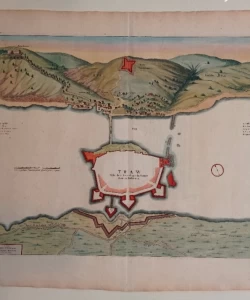
Coronelli Vincenzo: Chnin - Fortezza nella Dalmatia
€ 600,00
Free delivery in Croatia for orders over EUR 70
Basic information
- Author: Coronelli Vincenzo
- Publisher: -
- Availability: Available
- Condition: Vrlo dobro
- Code: 48620
Shipping options
GLS Croatia
5€
Delivery
0€
Personal collection at the antique store
0€
GLS parcel machine
3€
Payment methods
Pay on pickup
CorvusPay
By general payment / Virman / Internet banking
Cash on delivery
Chnin - Fortezza nella Dalmatia
Coronelli Vincenzo
Summary
Vincenzo Coronelli: Chnin - Fortezza nella Dalmatia
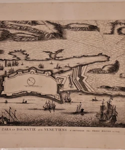
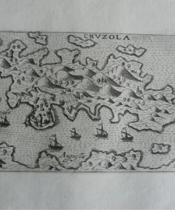
Vincenzo Maria Coronelli (1650-1718), theologian, cosmographer, geographer, cartographer and publisher. From 1667 to 1671, he studied astronomy with Pietro Martira Rusca. In 1671, he joined the Franciscan order and lived in the Venetian monastery of S. Marie Gloriose dei Frari in Venice. He studied theology and humanities in the Roman college of S. Bonaventura, where he also studied Euclid's geometry. He received his doctorate in Rome in 1973. During his stay in Padua, from 1674 to 1677, he researched Euclid's geometry together with Count Francesco Damiani. He was involved in geography, history, cartography, copper engraving, turning the globe and construction. At the request of Duke Rannucio Farnese, he made the first globe in 1678. Uvenecia enjoyed a great reputation and had access to the secret archives of the Republic of Venice in order to obtain data for making maps. It is assumed that Coronelli himself read his maps on a copper plate. In 1685 (or 1686) he published two works on Morea, Conquiste della Republica in Dalmazia Epiro e Morea and Memorie historiografiche del Regno di Morea e di Negroponte. Before he printed the work in 1685, the people of Dubrovnik decided to reward him with twenty sequins if he published a text about the Republic of Dubrovnik. Coronelli entered the sent data, so it is the first preserved geographical map on which the area of the Republic of Dubrovnik is shown quite accurately and reliably. The map was published in that edition, but also in his other works with the title Stato di Ragusi, Bocca del Fiume Narentam, Isole di Lesina e Curzola ella Dalmatia posseduta Dalla Serenissima Republica di Venetia. On it, you can see the coastal belt from Makarska to Boka Kotorska, and all the larger Adriatic islands at sea. Coronelli also attached a graphic representation of the route of the caravan route from Dubrovnik to Constantinople Viaggio da Ragusi a Constantinopoli per la Bosa, Servia, e Romania. In that island there is a map of the wider area of Zadar, Contando di Zara, Parte della Dalmatia. Considering its size and scale, it is a very detailed map, so it can be considered the first topographical map of the area. His greatest cartographic work I Atlante Veneto, an atlas whose first volume was published in 1691, and the second in 1695. In Venice in 1680 he founded the first geographical society, the Accademia Cosmographica degli Agronauti, one of the oldest geographical societies in the world. His intention was to develop a publishing activity in order to organize the distribution of his works throughout Europe
Additional information
- Author: Coronelli Vincenzo
- Publisher: -
- Year of publication:1690
- Place of publication:Venecija
- Pages:/
- Dimensions:58x44 cm
- Script:Latinica
- Condition:Vrlo dobro
You may also like


Biblos Newsletter
For book lovers who enjoy finding the rare
New titles, special copies and quiet recommendations from the antiquarian bookshop.