Summary
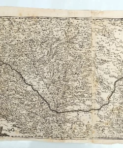
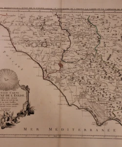
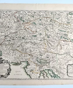
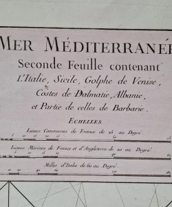
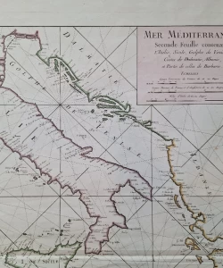
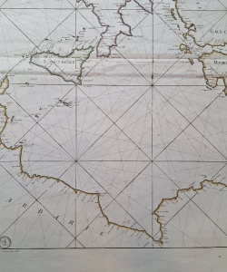
Depot de la Marine (J. Bellin): Mer Mediterranee Seconde Feuille contenant L'Italie, Sicile, Golphe de Venise, Costes de Dalmatie, Albanie, et Partie de celles de Barbarie.
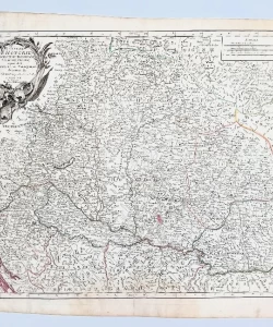
The middle sheet of a maritime map of the Mediterranean, showing the Adriatic Sea and the entire Croatian coast in imperial folio format. Etching, color, wide margins and excellent condition.
Finely engraved map of Italy and the central part of the Mediterranean, published by Depot de la Marine.
The map was printed under the direction of Dépôt des cartes et plans de la Marine by Jacques-Nicolas Bellin.
Jacques-Nicolas Bellin (1703-1772) was one of the most important cartographers of the eighteenth century. In 1721, at the age of 18, he was appointed hydrographer of the French navy. In August 1741, he became the first Ingénieur de la Marine Dépôt des cartes et plans de la Marine (French Hydrographic Office) and was appointed official hydrographer of the King of France.
Biblos Newsletter
New titles, special copies and quiet recommendations from the antiquarian bookshop.