Summary
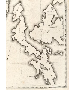
Jung: Map of Istria and Kvarner
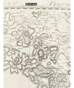
Topographical and military atlas of Germany in German and French. In 204 separate sheets of numbered sections, on sheets. Some leaves consist of two parts. Some sheets have an index on the back. The area covered includes parts of Poland, the Czech Republic, northern Italy, Austria, Switzerland and Yugoslavia. Maps made between 1807-1813, showing major cities, fortresses, towns, roads, post offices, landmarks, forests, rivers and mountains. Relief shown with snaps and shape lines.
"Topografsku vojnu kartu Njemačke objavio je od 1807. do 1813. Friedrich Wilhelm Streit (1772.-1839.) u Geografskom institutu u Weimaru.
Karta bi trebala biti korisna putnicima, ali i znanstvenicima i vojsci. Proteže se od obale Baltičkog mora na sjeveru do Jadranskog mora na jugu i od njemačko-francuske granice na zapadu do zapadne Poljske i Mađarske na The northern part of the island of Rügen is on sheet number 1. Sheet number 4 contains the island of Heligoland and three views of the island.
Biblos Newsletter
New titles, special copies and quiet recommendations from the antiquarian bookshop.