
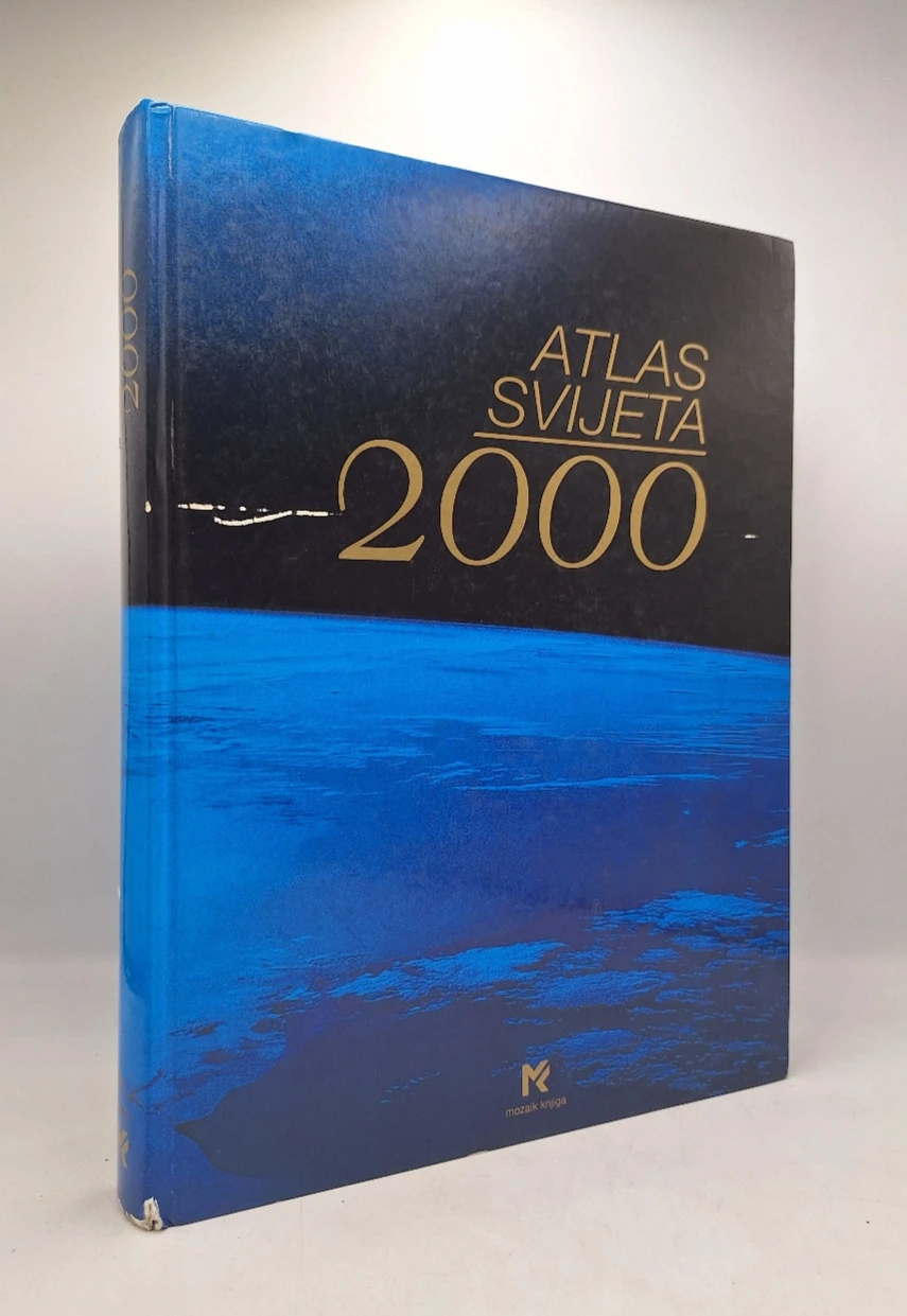
Atlas svijeta 2000
Basic information
- Publisher: Mozaik knjiga d.o.o.
- Availability: Available
- Condition: Very good
- Code: 21435
Shipping options
Payment methods
Explore more
Atlas svijeta 2000
Summary
World Atlas 2000
A new view of the Earth.
Cartography:
Project leaders: Dieter Meinhardt, Eberhard Schäfer.
WORLD ATLAS 2000 is a new, revolutionary project created by the renowned Bertelsmann cartographic institute in collaboration with top geographers and cartographers from around the world. It is a successful combination of rich experience and tradition as well as new knowledge and technical possibilities of cartography. The most modern computer and satellite technology enabled the execution of this unique cartographic work: The whole world in a unique scale Maps of extraordinary plasticity Climate and vegetation characteristics of the area Display of the entire traffic network world
Most valuable natural and cultural sights
Fantastic satellite images
ATLAS OF THE WORLD 2000 sets new benchmarks in graphic design, abundance of information and practical utility value. On more than 400 pages, the whole world is presented in a unique scale of 1:4,500,000. Central Europe with Croatia is additionally shown in a scale of 1:900,000. All this, along with 135 color photos and 20 satellite images, enables a completely new view of the Earth.
Additional information
- Publisher: Mozaik knjiga d.o.o.
- Year of publication:2000
- Place of publication:Zagreb
- Pages:376
- Dimensions:27x35 cm
- Script:Latin script
- Condition:Very good
- Binding:Hardcover
Reviews
0 reviewsWrite a review
Share your experience and help other readers choose.
This item has no reviews yet. Be the first to share your experience.
More books from Mozaik knjiga d.o.o.













You may also like




Recently viewed