


Summary
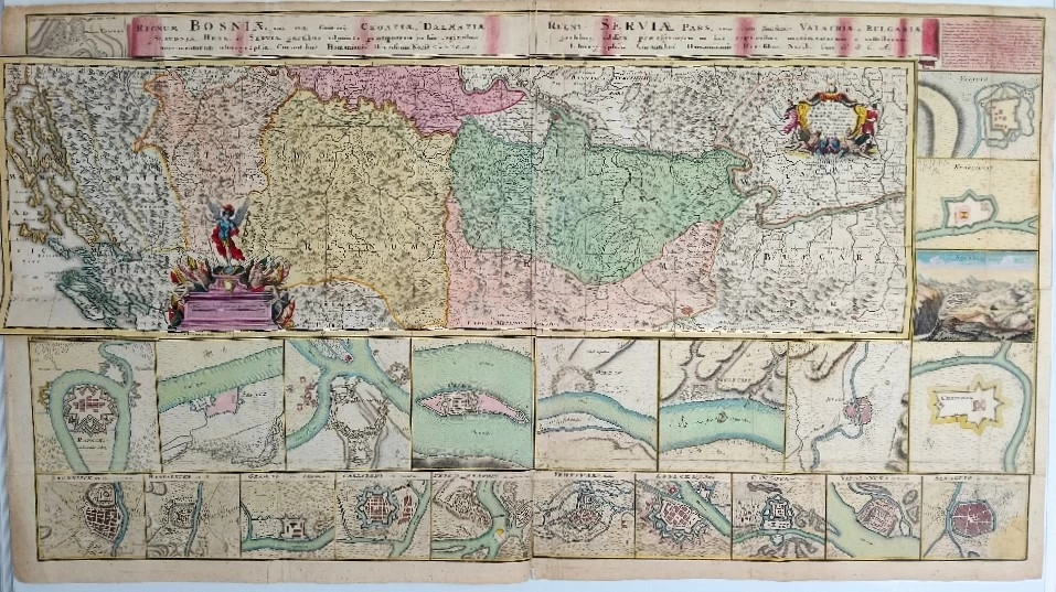
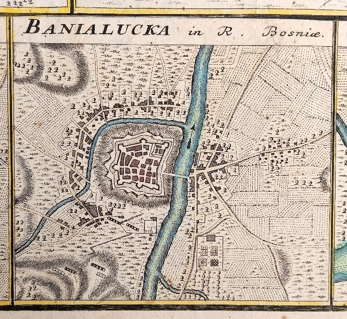
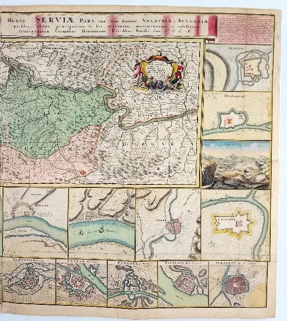
Johann Friedrich Ottinger: Regnum Bosniae, una cum finitimis Croatiae, Dalmatiae, Slavoniae, Hungariae et Serviae partibus, adjuncta praecipuorum in his regionibus munimentorum iconographia. Regni Servia pars, una cum finitimis Valachiae, Bulgariae partibus, addita praecipuorum in his regionibus munimentorum et castellorum iconographia. - Map of the Kingdom of Bosnia, Serbia and neighboring countries
This map shows the new position of the border of Bosnia, Serbia and neighboring countries established after the peace in Požarevac in 1718. It covers the battlefield between the Austro-Hungarian Empire under Charles VI. and the Ottoman Empire under Ahmet IV. The cities shown are Vidin, Nikopol, Niš, Čačak, Sarajevo, Kragujevac, Valjevo, Užice, Brod, Bihać, Zvornik, Rača, Šabac, Belgrade and Oršava.
Johann Friedrich Ottinger: German military engineer and cartographer of the second half of the 18th century. In 1760, he made a map of Servia for Homan's heirs. He published Regnum Bosniae una cum finitimis Croatiae, Dalmatiae, Slavoniae .. partibus for the same cartographic workshop and publishing house in the 1730s. LIT: https://digitalna.nsk.hr/pb/?object=info&id=11284, access 7/13/2018. Bonacker, 1966, 172; Tooley, 1797, 479.
Biblos Newsletter
New titles, special copies and quiet recommendations from the antiquarian bookshop.